Campus Development Plan
In 1956, Manchester City Council relinquished ownership of the Manchester Municipal College of Technology, which it had run since 1892. It was succeeded by the Manchester College of Science and Technology (MCST).
MCST had its own charter and enjoyed considerable control over its own curriculum, but retained the close links to the University of Manchester, which it had enjoyed since 1905 agreement between the two institutions.
The College's Principal, Vivian Bowden (later Lord Bowden of Chesterfield), wanted a radically different type of university education, with new subjects and pedagogical methods. Bowden set out his vision in detail in his Proposals for the Development of the Manchester College of Science and Technology (1956).
This plan envisaged a major expansion in staff and students. With increased numbers and the need for better teaching and research facilties, a completely reconstructed campus was required.
This campus plan attuned with Manchester City Council’s radical urban redevelopment plans, which moved housing and industries from the city's central core to the suburbs. The area surrounding MCST was a suitable case for such redevelopment.
In the mid-1950s, Manchester Council allocated the College an area of 27 acres to the south of its existing buildings. A building plan was drawn up by the distinguished Manchester architect Sir Hubert Worthington, which divided this area into three zones: Areas A, B and C.
The clearance of these areas began shortly after the much-delayed College extension to its Main Building opened in November 1957.
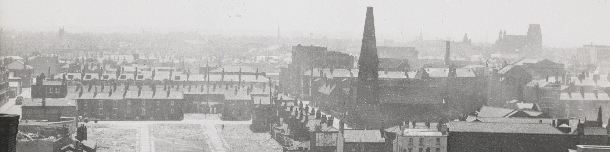
Area A was the core of the new campus. Area A was bounded by the railway viaduct, London Road, Sackville St and what is now the Mancunian Way. The heavily polluted river Medlock flowed through the middle of it.
By the late 1950s this area had been cleared, with nearly all its existing landmarks being demolished, including St Luke’s Church which can be seen in the right- hand section of this photograph.
The new Kodak building fronting Sackville St can be seen in the left-hand corner of the photograph; this was converted into UMIST’s Paper Sciences Building (renamed the James Lighthill building). Almost every other building in the foreground of the photograph was demolished.
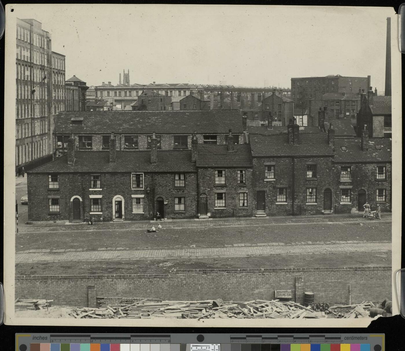
This street no longer exists. It housed families who worked in the local area including the Jackson St Spinning Mill. The housing was scheduled for slum clearance and the site was later occupied by the Ferranti building and the MSS Tower. The UMIST redevelopment assumed that there would be no residential housing in the immediate vicinity of the campus.
The Jackson St Mill was a relatively modern building (reconstructed in the early 20th century from an earlier building). It was therefore considered viable for redevelopment after the cotton mill ceased operations in 1955. It was converted in a remarkably short period of time, reopening in May 1958 as the Chemical Engineering building (also housing biochemistry, textile chemistry and metallurgy). The conversion was undertaken by H S Fairhurst and Son, who later designed the associated Chemical Engineering (Morton) building.
Reusing the Mill was intended to be a temporary arrangement until a replacement building was commissioned. However, Chemical Engineering remained at this site until the closure of North Campus. Latterly, the building was known simply as The Mill.
Like all cotton mills running on steam power, it had a tall chimney. This was demolished during conversion. The River Medlock which ran alongside the building was also culverted in the first phase of development.